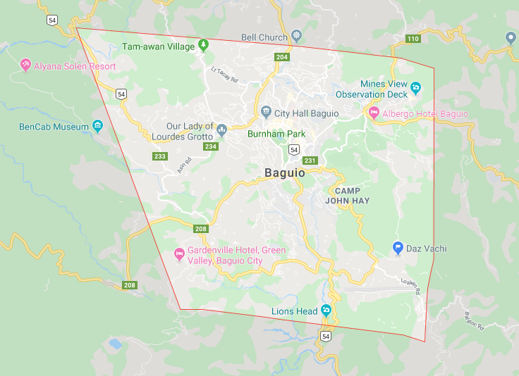
The city of pines with its hilly terrain, panoramic mountainscape, and beautiful native people.
No one would think that this mountain resort city would have some geological hazards.
Baguio City considered a small town with its major developments in the northern part and spreading out.
Where every Filipino that has come to Baguio and even a foreigner would like to have a piece of real estate property here.
That is why real estate property demand is always high.
I got most of the information on my blog content, in the presentation slides of Engr. Ralph C. Pablo, DPA, En. P. Regional Executive Director DENR.
When he had a talked on the First-Ever Land Summit in Baguio City held in Pedro Dumol Hall BENECO South Drive.
On his presentation slides, he showed the DENR’s data where most of the major landslide affected areas, sinkholes, fault line, and many other more.
Which on this blog article.
I’ll only tackle the 3 most asked questions of my clients when I show them around for ocular inspection around Baguio.
Most of the time my clients would ask;
Is that a landslide-prone area?
That place is near to the fault line right?
I don’t like that place because they said it has lots of sinkholes, am I right?
Can you recommend an area that is safe from everything?
Disclaimer:
First of all, I am sharing this information not to discourage or defame these areas of Baguio but to inform the public.
To be aware if they would like to buy or invest in a property on these affected areas of Baguio.
Because as we know if these geological hazard events would take effect it will cause damage to real estate properties which will be in the 7 figures.
Baguio City has only 5,752.0056 hectares of land, the only alienable disposable area is 2,920.3738 hectares which makes Baguio’s titled lands more scares.
If you are planning to sell your titled property in Baguio then contact me.
That is why even these areas of Baguio are prone to this hazard. people don’t mind to build their houses because of scarcity on land also regulations by the government is not much implemented.
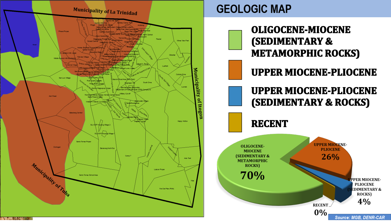
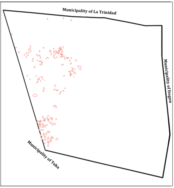
Geologic Map of Baguio
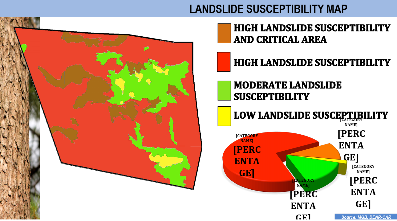
Landslide Susceptibility Map
“According to the MGB, up to 80 percent of the country’s total land area is landslide-prone, making the country the fourth most exposed to landslide risk, after Indonesia, India, and China.
The Cordillera region has the highest risk of landslides in the Philippines.” – source https://reliefweb.int/report/philippines/philippines-landslide-risk-increasing
As a result, this is why you need a local professional realtor or geodetic engineer.
To know the area in Baguio you are prospecting is safe on landslide and other geological hazards.
Fault Line in Baguio
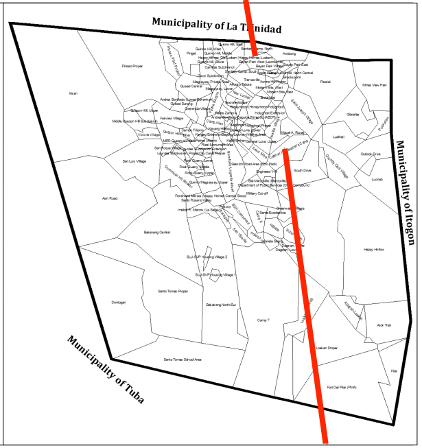
List of Affected Barangays
-Loakan Proper
-Loakan Liwanag
-Greenwater Village
-South Drive
-Cabinet Hill-Teacher’s Camp
-Dagsian, Upper
-Scout Barrio
-Fort Del Pilar (PMA)
-Sanitary Camp, North
-Bayan Park West (Leonila Hill)
Sink Holes in Baguio
List of Affected Barangays
-Asin Road
-Bakakeng Central
-Dominican Hill Mirador
-Dontogan GreenValley
-Fairview Village
-Irisan
-Lourdes Subdivision Extension
-Lourdes Subdivision, Lower
-Lourdes Subdivision, Proper
-Middle Quezon Hill Subdivision
-Pinget
-Pinsao Pilot Project
-Pinsao Proper
-Quezon Hill Proper
-Quezon Hill, Upper
-Rock Quarry, Lower
-Rock Quarry, Middle
-San Luis Village
-San Roque Village
-Santo Tomas Proper
-Victoria Village
Conclusion
Baguio City is a safe home for everyone, you only just need to give due diligence and double-check everything if you want to protect your life and asset.
Hence why you should get a professional experts’ opinion on properties that we are prospecting.
Therefore, it does not mean that the barangay community that was mentioned above is unsafe or inhabitable.
It is already the discretion of each person if he/she wants to live in that place because of preference and other factors.